
The maps in this folder have been customized to be printed in black-and-white. In themajority of the maps, countries are not labeled so that they may be used inclassroom exercises. Please, select a map by clicking on a desired map image below.
Note. To view these maps you will need Adobe Acrobat Reader. If you do not have it, you may download it here for free.
Learning Module Maps
Average Annual Population Growth Rate, 1980-98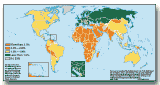 | Life Expectancy at Birth, 1998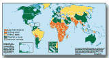 | GNP per Capita, 1998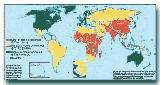 | Access to Safe Water, 1990-96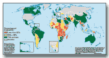 |
World and Regional Maps
World Map, 1997 (labeled) | World Map, 1997 (unlabeled) |
Asia (South & East) and the Pacific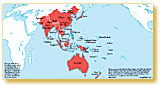 | Europe and Central Asia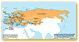 | Middle East and North Africa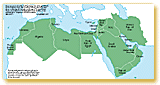 |
North and Central America and the Caribbean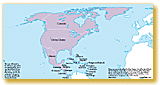 | South America 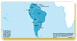 | Sub-Saharan Africa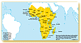 |
Home | Site Guide | Modules | What's SD? | SD Post | Resources | About DEP
| Copyright © 2000 IBRD/The World Bank | dep@worldbank.org |